Land Use Notes
Last updated July 5, 2022
By Emma Howland
Getting Started: Open the “Project Data” word file in the Specifications folder within the project. It is also a good idea to open these sites in your browser:
- County GIS map (ex: King County IMAP/ parcel viewer)
- open assessors report to view property detail- here you will find under Parcel Data and Land Data: Property Owner Name, Zoning, Parcel Number, Lot Area, Sewer/Septic info
- note- The legal description shown here is abbreviated
- Take a screenshot of the map with only the parcel layer turned on. Open in photoshop and edit to be black and white, outline the property in a thick black line and add a black dot on the center of the property.
- open assessors report to view property detail- here you will find under Parcel Data and Land Data: Property Owner Name, Zoning, Parcel Number, Lot Area, Sewer/Septic info
- County Online Records Search > Search for the full Legal Description: search by parcel number and look at the Deed of Trust, (exhibit A)
- You may also find records of survey data/ easement information for the property that will help with drafting the site plan
- Google Maps > Take a screenshot of the aerial view of the property and save in “Project Info & Notes” to use as an overlay while drafting the site plan
- The Land Use Code for the jurisdiction (ex. Title 18 in Newcastle Municipal Code)
Project Info & Description
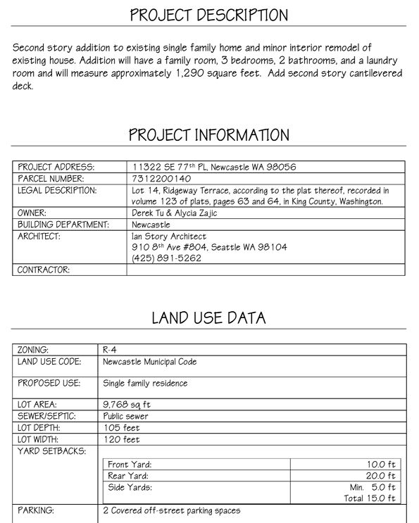
Tip- for the project description, keep it simple (as if you are explaining the project to a contractor in 3 sentences or less. )
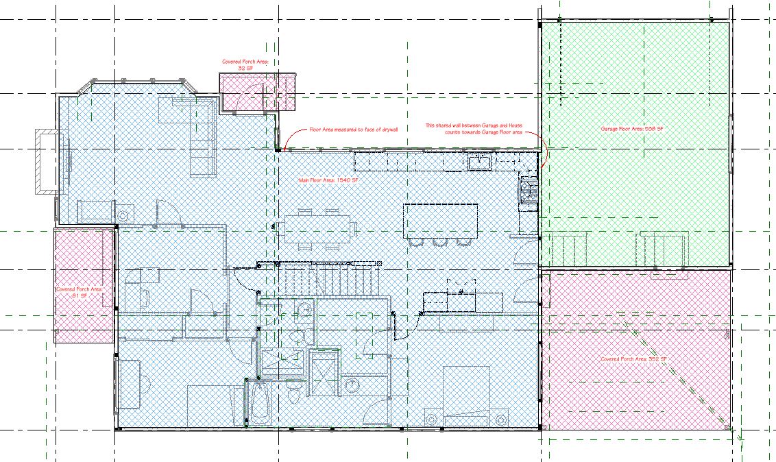
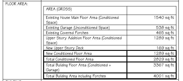
Floor Area Calculation
Floor Area: Break out each area separately in the table, ex: Existing House Main Floor Area, Existing Garage (Unconditioned Space), Existing Covered Porches…etc
Land Use Calculations
The next few categories in the land use data table depend on the Jurisdiction’s code requirements. Check the exact verbage and definitions for each code requirement in their Land Use tables.
Ex. Below is the Density and Dimensions table from Title 18 (Zoning) in Newcastle’s Municipal Code. This property is in the R-4 zone
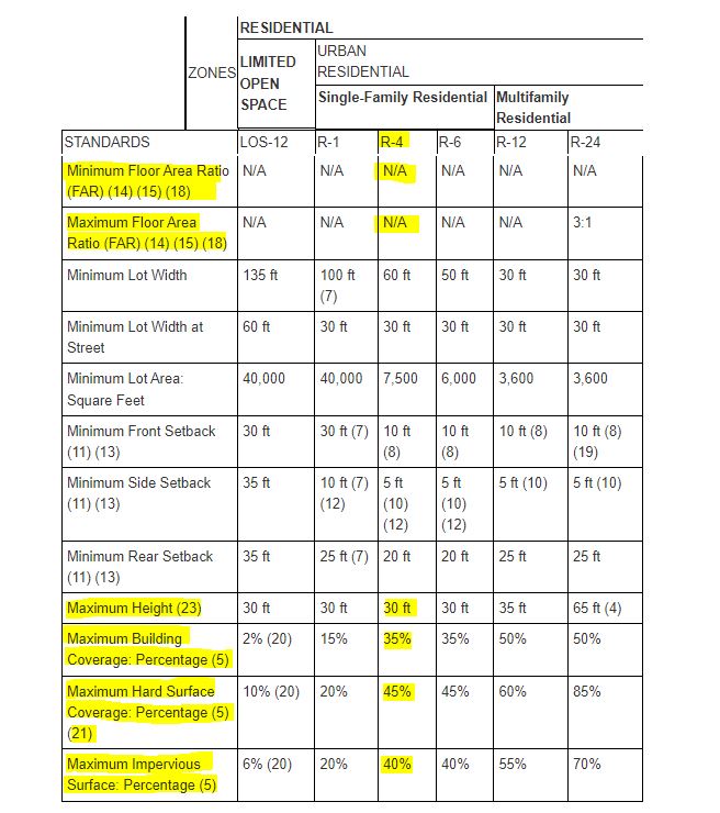
- Floor Area Ratio is not applicable (N/A) to zone R-4
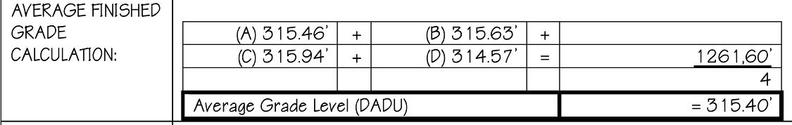
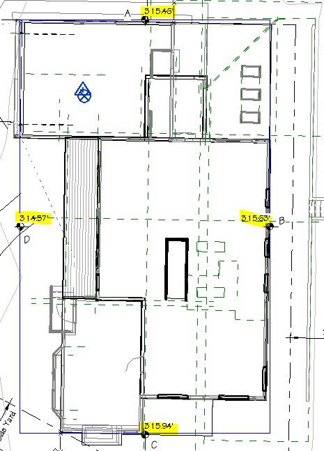
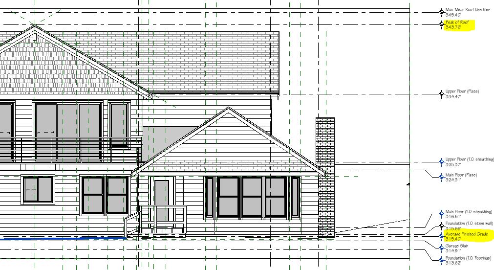
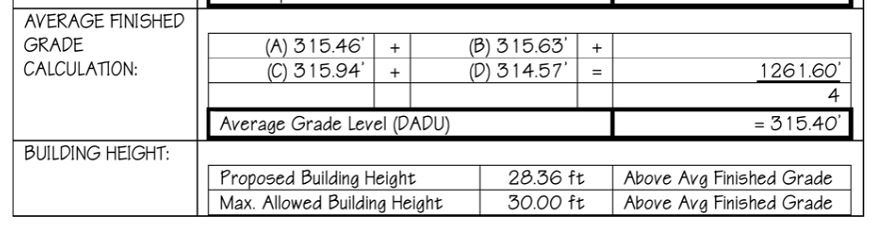
- Maximum Height (Specified as measured using “Average Finished Grade” – check definition to find how it is calculated)
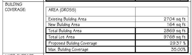
- Maximum Building Coverage Percentage (check footnote (5), as well as the code definition to find how it is measured)
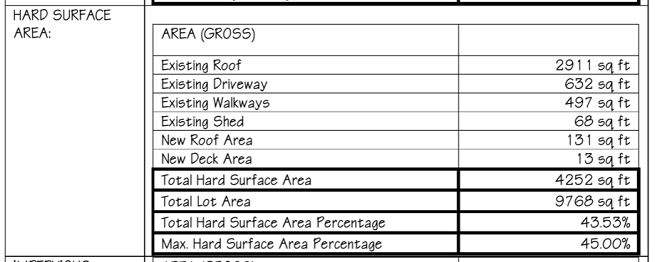
- Maximum Hard Surface Coverage Percentage (check footnotes (5) and (21), as well as the code definition to find how it is measured)
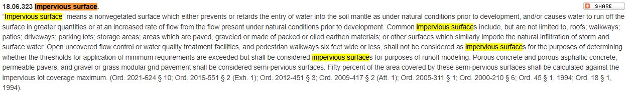
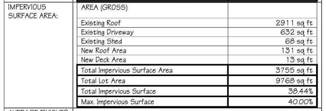
- Maximum Impervious Surface Percentage (Check footnote (5), as well as the code definition to see what they count exactly towards impervious Surface)